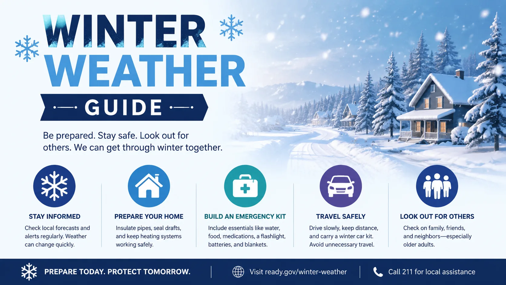
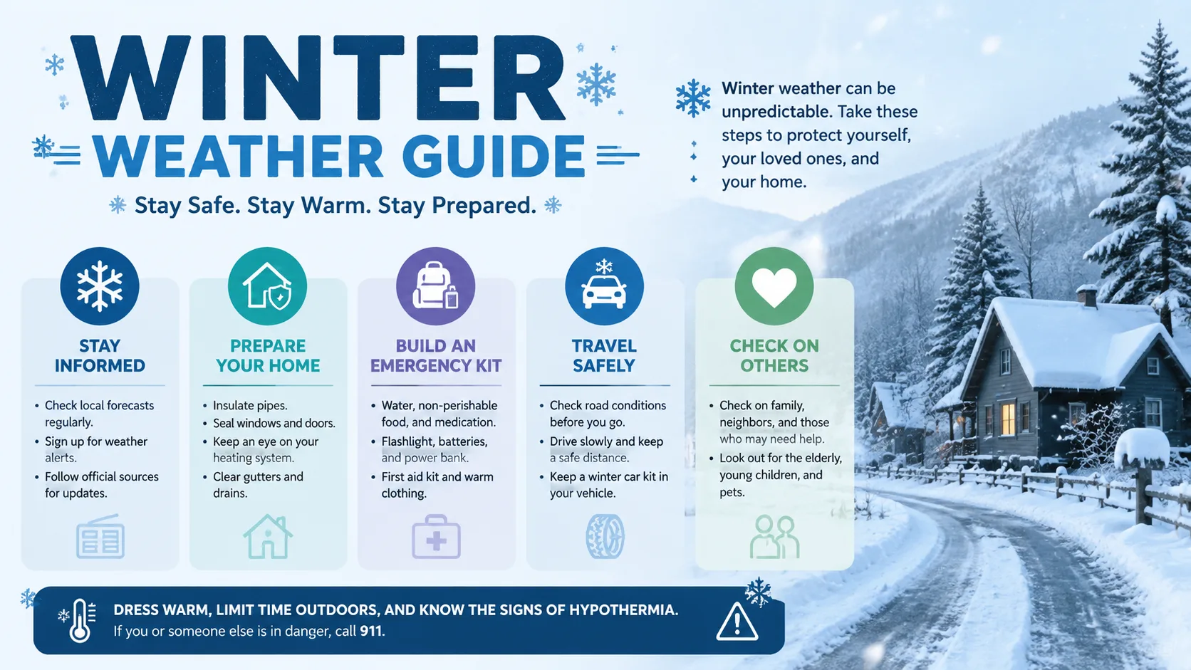
When winter arrives, parents juggle childcare plans, students check their phones before sunrise, and school superintendents quietly study radar charts in the dark. A winter weather guide that covers both snow types and school closure decisions in one place is exactly what families need and that is what this article delivers.
Whether you are in Buffalo where four inches is just a Tuesday, or in Atlanta where a forecast of one inch triggers citywide panic, the science behind winter precipitation and the logic behind school closures apply to everyone. Let us break it all down.
What Is Winter Weather? A Plain-Language Overview
Winter weather is any atmospheric condition during cold months that involves precipitation snow, sleet, freezing rain, or ice combined with temperatures at or near freezing. The National Oceanic and Atmospheric Administration (NOAA) classifies winter storms as events combining heavy snow, blowing snow, and/or dangerous wind chills.
Winter weather is not just about snowflakes. The type of precipitation that falls, and how roads and sidewalks respond to it, determines whether a community functions normally or shuts down entirely.
From a safety perspective, precipitation type matters more than total accumulation. Just one quarter inch of freezing rain can be more disruptive than six inches of powdery snow, because it turns every surface into an ice rink.
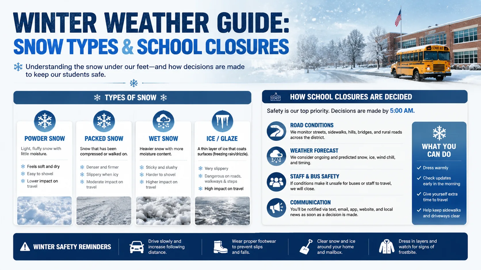
The 6 Main Types of Winter Precipitation Explained
All winter precipitation starts the same way — as ice crystals forming high in the clouds. What determines whether it reaches the ground as snow, sleet, or freezing rain is the temperature of the air layers it passes through on the way down.
Snow
Forms when air temperature stays at or below 0°C (32°F) from cloud base to ground. Snowflakes reach the surface without melting. 10 inches of snow equals roughly 1 inch of water.
Freezing Rain
Snow melts into rain as it passes through a warm air layer, then "supercools" through a shallow cold layer near the surface. It freezes instantly on contact. The most dangerous type.
Sleet (Ice Pellets)
Similar to freezing rain, but the cold layer near the surface is deeper. The raindrop has time to refreeze before hitting the ground. Makes a distinct "pinging" sound on impact.
Blizzard
Defined by winds over 35 mph with blowing snow reducing visibility to 1/4 mile or less for at least 3 hours. Heavy accumulation is not required — wind is the defining factor.
Lake-Effect Snow
Occurs when cold, dry Arctic air moves over warmer Great Lakes water, picking up moisture and depositing it as intense, localized snowfall often 1–2 feet south and east of the lakes.
Graupel
A rare hybrid snowflakes that partially melt and collect supercooled water droplets, forming soft pellets. Not fully snow, not fully sleet. Indicates convective instability in winter air.
Snow vs. Sleet vs. Freezing Rain: What Is the Difference?
The key difference is the depth of warm air layers above the surface. All three begin as snowflakes in the cloud.
- If it stays cold all the way down: snow.
- If it melts, then has enough distance to refreeze before hitting the ground: sleet.
- If it melts but only has a thin cold layer near the surface not enough time to refreeze: freezing rain.
Why Freezing Rain Is the Most Dangerous Winter Precipitation
A thin quarter-inch glaze of freezing rain coats roads, sidewalks, car windshields, power lines, and tree branches simultaneously. Unlike snow, which has texture that provides some tire traction, freezing rain creates a perfectly smooth sheet of ice.
A quarter-inch accumulation of ice can bring down power lines, snap tree branches, and cause more school closures than six inches of powder snow. Southern states, where de-icing infrastructure is limited, face the worst outcomes during ice events.
📊 School Closure Risk by Precipitation Type
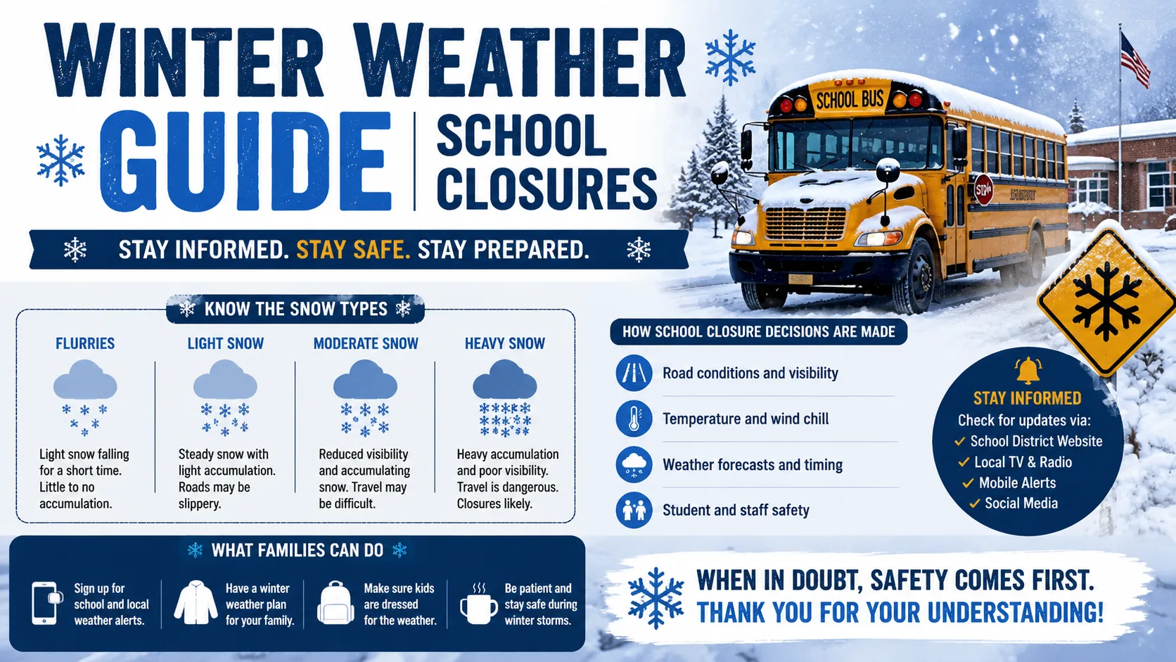
How Do Schools Decide to Close for Winter Weather?
There is no universal formula. No law says "close when 4 inches falls." Each school district superintendent makes the call, weighing a combination of safety signals specific to their community.
The 7 Factors Superintendents Consider Before Closing Schools
Road and Bus Route Conditions
School buses travel long rural routes that are plowed last. If a bus cannot safely climb a hill or stop on an icy road, schools close regardless of downtown conditions.
Wind Chill Temperature
Many districts have specific wind chill thresholds. Northern districts may act at -20°F wind chill. Southern districts may close at temperatures well above that. Extreme cold is dangerous for students waiting at bus stops.
Precipitation Type, Not Just Amount
Ice storms trigger immediate closures even with no snow accumulation. A quarter inch of freezing rain outweighs six inches of dry powder in the superintendent's risk calculation.
Timing of the Storm
Snow that peaks at 7 a.m. during the morning commute forces closures. The same storm arriving at noon may only affect after-school pickup. Peak storm timing is critical.
Parking Lot and Sidewalk Clearance
Transportation crews often start prepping buses as early as 4 a.m. If lots and walkways cannot be safely cleared in time, operations cannot safely proceed.
Local Infrastructure and Equipment
Northern districts pre-stage plows and salt trucks. Southern districts may have one plow for an entire county. The same six-inch storm hits these areas completely differently.
Visibility and Walking Conditions
Blizzard-level visibility below one quarter mile is dangerous for walkers, cyclists, and drivers. Drifting snow across rural roads reduces traction and creates hidden hazards.
Regional Snowfall Thresholds: How Much Snow Closes Schools?
School closure thresholds vary dramatically by region. A storm that shuts down Atlanta for three days would barely register in Minneapolis. This is not negligence it reflects real differences in infrastructure, experience, and community preparedness.
| Region | Typical Closure Threshold | Key Notes | Ice Response |
|---|---|---|---|
| Northeast (NY, MA, CT, PA) | 6–10 inches | Well-equipped fleets; experienced staff | Immediate closure for any ice storm |
| Midwest (MN, WI, MI) | 8–12+ inches | Built for winter; predictable patterns | Close for dangerous wind chills (-20°F) |
| Mid-Atlantic (MD, VA, NC) | 3–6 inches | Variable; ice events common | Close faster than snow; mixed storms common |
| South (GA, SC, TN, AL) | 1–2 inches | Minimal equipment; low experience | Forecast of ice often closes before storm arrives |
| Great Plains (KS, NE, IA) | 5–8 inches | Wind and drifting snow key factors | Blizzard conditions trigger closure |
| Pacific Northwest (OR, WA) | 2–4 inches | Hilly terrain; light equipment | Freezing rain on hills = immediate close |
| Great Lakes (lake-effect zones) | 10–18 inches | Experienced; lake-effect bands unpredictable | Sudden intense bands can override normal thresholds |
Check your district's specific wind chill policy. Many districts have a published threshold such as -15°F or -20°F wind chill at which they automatically close, regardless of precipitation totals. This is separate from the snow accumulation decision.
Delay vs. Full Closure: What Is the Difference?
Not every winter event leads to a full school closure. Superintendents have a middle option: the two-hour delay. This shifts the start time to allow:
- Road crews more time to plow and salt overnight snow.
- Temperature to rise slightly above the overnight low, reducing black ice.
- Daylight to improve visibility for bus drivers and walkers.
- Parents and staff more time for safe travel.
A delay is used when conditions are borderline dangerous at 6 a.m. but expected to improve by 9 a.m. A full closure is declared when conditions will remain dangerous throughout the day or when ice, extreme cold, or blizzard conditions make any travel unsafe.
What About E-Learning Days?
An increasing number of districts now use e-learning days instead of traditional "snow days." These count as full instructional days, meaning the school year does not need to be extended. Students complete digital assignments from home, and teachers remain available by email during school hours.
Most states cap e-learning days at five per school year. This option has reduced the number of true school cancellations in districts that have adopted it.
Read More : Adopt Me Trading Calculator
How to Use a Snow Day Calculator
A snow day calculator is an online tool that estimates the probability of school closure based on your location's weather forecast. These tools have become a daily ritual for millions of students and parents each winter.
Here is how they work and how to get the most out of them:
Enter Your Location
Type your ZIP code, city name, or postal code. Most calculators pull live data from the National Weather Service and regional weather APIs for your specific area.
Review the Probability Score
You will see a percentage like "78% chance of snow day." This is based on snowfall totals, temperature, wind chill, precipitation type, and historical closure patterns for your region.
Check Timing and Storm Peak
Look at the hourly forecast. A storm peaking at 7 a.m. is far more disruptive than one arriving at noon. The timing of peak snowfall dramatically affects the closure decision.
Factor In Your Region
A 70% score in Boston means something different than a 70% score in Nashville. Southern schools close at much lower thresholds. Most good calculators account for regional differences.
Check Official District Communications
A calculator is a planning tool, not an official announcement. Always confirm closures through your district's website, email alerts, or local news. Decisions are typically finalized by 9:30 p.m. the night before.
Most snow day calculators achieve 60–75% accuracy in clear-cut weather scenarios but are less reliable in borderline conditions. Use them as planning aids, not guarantees.
Winter Weather Alerts: Understanding NWS Warning Levels
The National Weather Service (NWS) issues standardized alerts at three levels to communicate how prepared communities should be. Knowing what each level means helps you gauge how serious a storm is before your district makes an announcement.
| Alert Level | What It Means | Typical School Response |
|---|---|---|
| Winter Weather Advisory | Hazardous conditions possible plan ahead | Monitor situation; possible delay |
| Winter Storm Watch | Severe winter weather likely within 48 hours | Early warning; districts begin planning |
| Winter Storm Warning | Severe winter weather imminent take action | High likelihood of delay or closure |
| Blizzard Warning | Winds over 35 mph + blowing snow reducing visibility to <1/4 mile | Almost certain closure |
| Ice Storm Warning | Ice accumulation of 0.25"+ expected | Immediate closure in most regions |
| Extreme Cold Warning | Life-threatening cold and wind chills | Closure regardless of precipitation |
How to Prepare Your Family for a Winter Storm School Closure
Closures are often announced the night before sometimes as late as 5 a.m. the morning of. The best preparation happens before the storm arrives.
For Parents
- Sign up for your school district's text and email alert system.
- Keep a backup childcare plan in place for unexpected closures.
- Ensure your children have proper cold-weather clothing before the season begins. Most schools have resources for families who face financial challenges in purchasing winter gear.
- If your child drives, put together a winter driving kit: ice scraper, jumper cables, blanket, sand or kitty litter for traction, and a flashlight.
For Students
- Check your district's website and official social media channels before any third-party calculator.
- If there is a 60%+ probability on a snow day calculator, prepare assignments in advance just in case.
- Know your e-learning platform and have it ready if your district uses online instruction days.
- Have a plan if you get stranded during a storm. Know the address of the nearest safe building on your route.
Common Mistakes Families Make During Winter Weather
- Assuming light snow means no risk. Even half an inch of snow on top of frozen roads creates dangerous driving conditions.
- Waiting for official announcements to start planning. A Winter Storm Watch issued 48 hours out is your signal to prepare now.
- Ignoring wind chill. At -10°F wind chill, exposed skin can develop frostbite in under 30 minutes. Children waiting at bus stops are especially vulnerable.
- Believing rain means no ice. Rain at 34°F can freeze instantly on bridge decks and overpasses, which cool faster than road surfaces.
Real-Life Winter Closure Examples: 2025–2026 Season
The 2025–2026 winter season illustrated how regional differences play out in practice:
- In February 2026, a major winter storm swept the U.S. Northeast. School districts across Connecticut and Massachusetts declared emergencies, triggering widespread closures as cities issued emergency declarations.
- In the Great Lakes region, a four-inch lake-effect snowfall in Buffalo opened school on time. The same storm total would have closed schools in Virginia for two days.
- Across Southern states, a forecast of just one inch of sleet led to preemptive school closures in several Georgia and Tennessee districts, reflecting limited de-icing capacity.
- In January 2026, wind chill advisories across the Upper Midwest triggered closures in Minnesota and Wisconsin despite minimal snow — because wind chills fell below -25°F, making bus stop waiting conditions life-threatening.
A four-inch snowfall in Buffalo is routine. The same storm in Raleigh is a regional emergency. Neither community is wrong in how it responds they are operating with different tools, different road networks, and different levels of community experience with winter driving.
Make-Up Days and E-Learning: What Happens After a Snow Day?
Snow days are not free days in the academic calendar. Schools must meet state-mandated minimum instructional hours each year.
- Most northern states build 3–5 "buffer" days into the school calendar. If unused, they become extra days off at the end of the year.
- Once buffer days are exhausted, closures must be made up through extended school days, shortened spring break, Saturday sessions, or a later end-of-year date.
- Some states, like New Jersey, require all snow days to be made up. Others, like Texas, have issued administrative waivers in extreme seasons.
- E-learning days bypass this problem entirely they count as full instructional days and do not need to be made up. Most states allow up to five per school year.
Conclusion: Knowledge Is Your Best Winter Tool
Understanding the difference between snow, sleet, freezing rain, and a blizzard is not just meteorology it is practical safety knowledge for every family. When you know that one quarter inch of freezing rain beats six inches of powder in terms of danger, you stop being surprised by school closures that seem to come "out of nowhere."
School superintendents are not making arbitrary calls. They are weighing bus routes, precipitation type, wind chill, storm timing, and community infrastructure simultaneously often in the early hours of the morning. The more you understand that process, the better you can prepare your family before the official announcement arrives.
Bookmark this guide, check a reliable snow day calculator when storms approach, and make sure your family has a plan before the first major storm of the season.
Also Checkout :