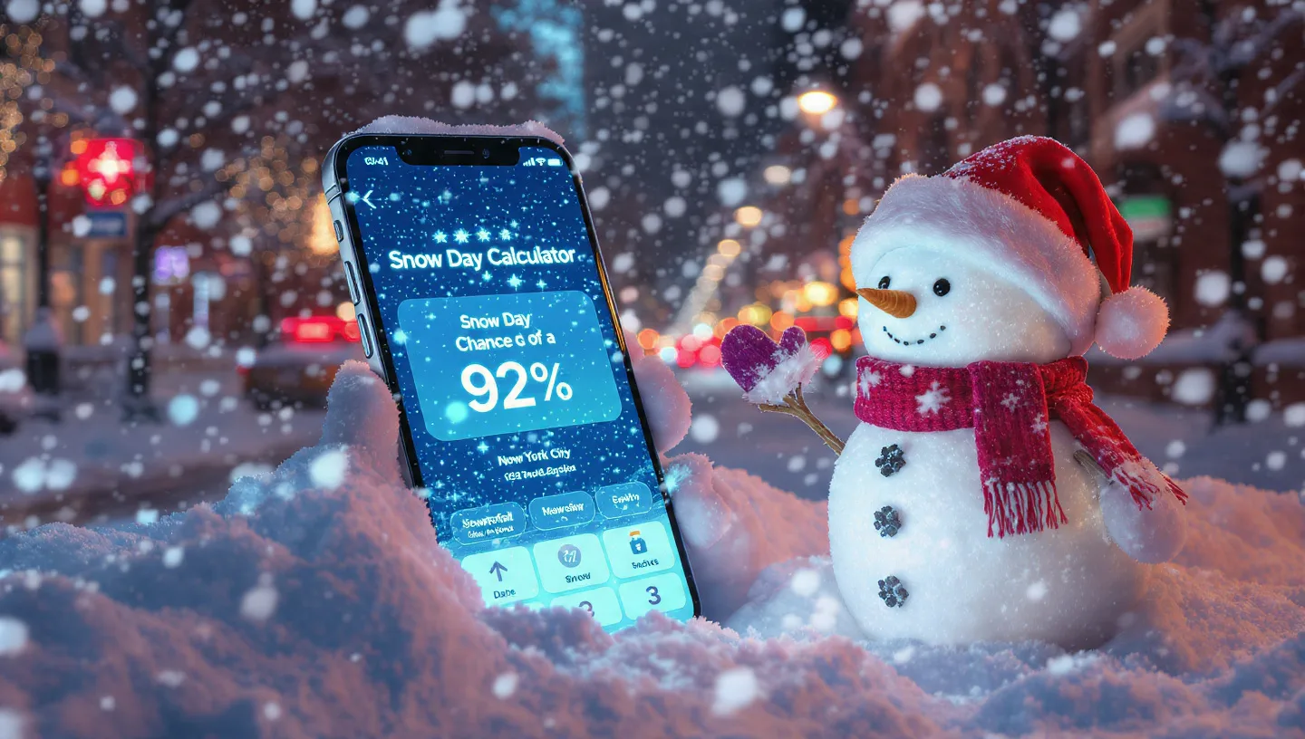
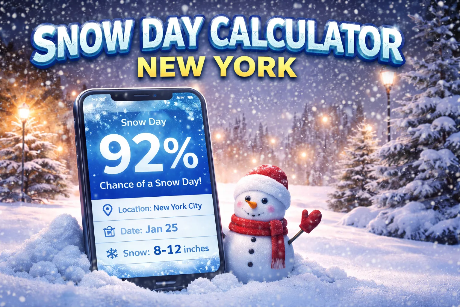
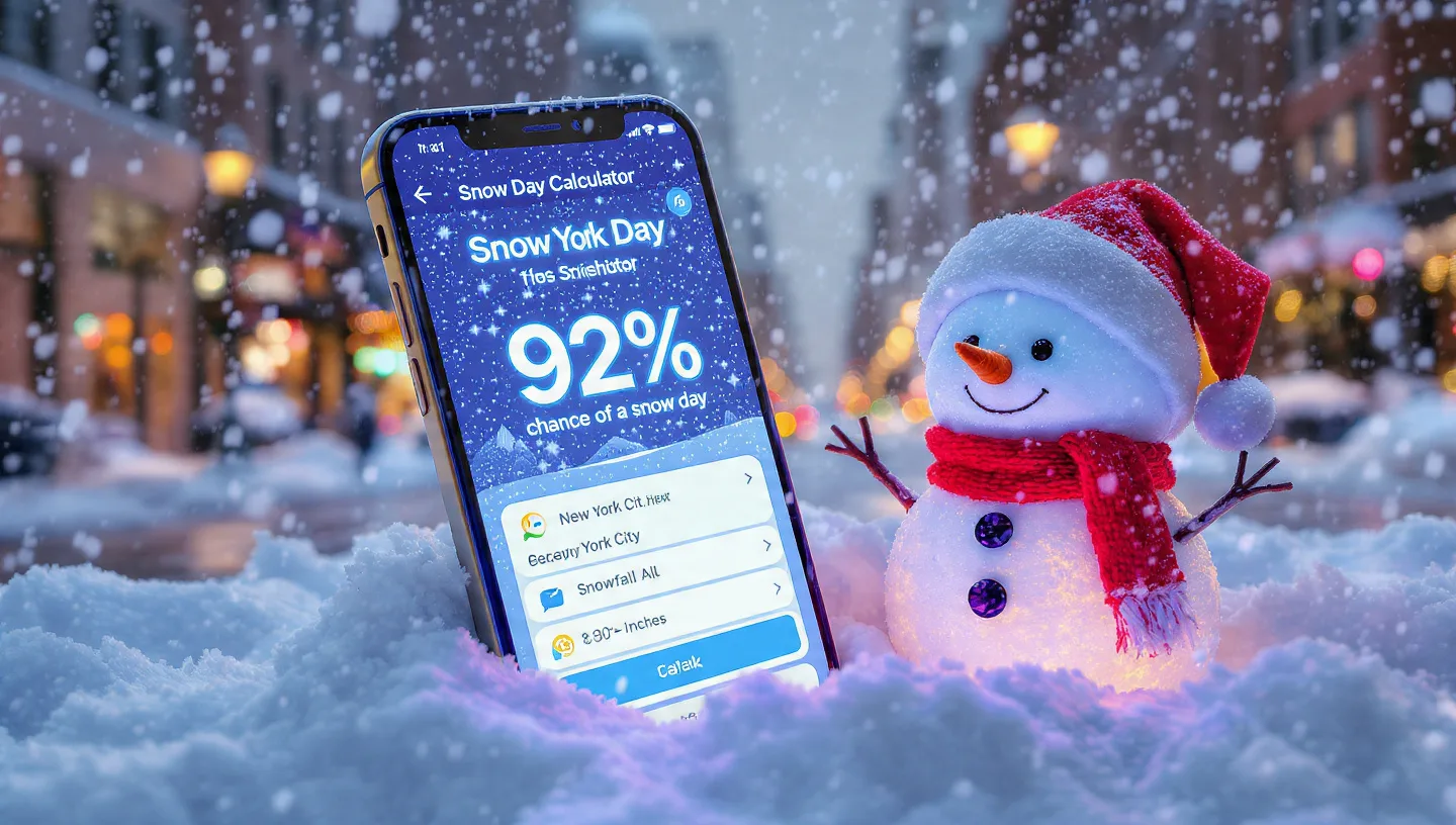
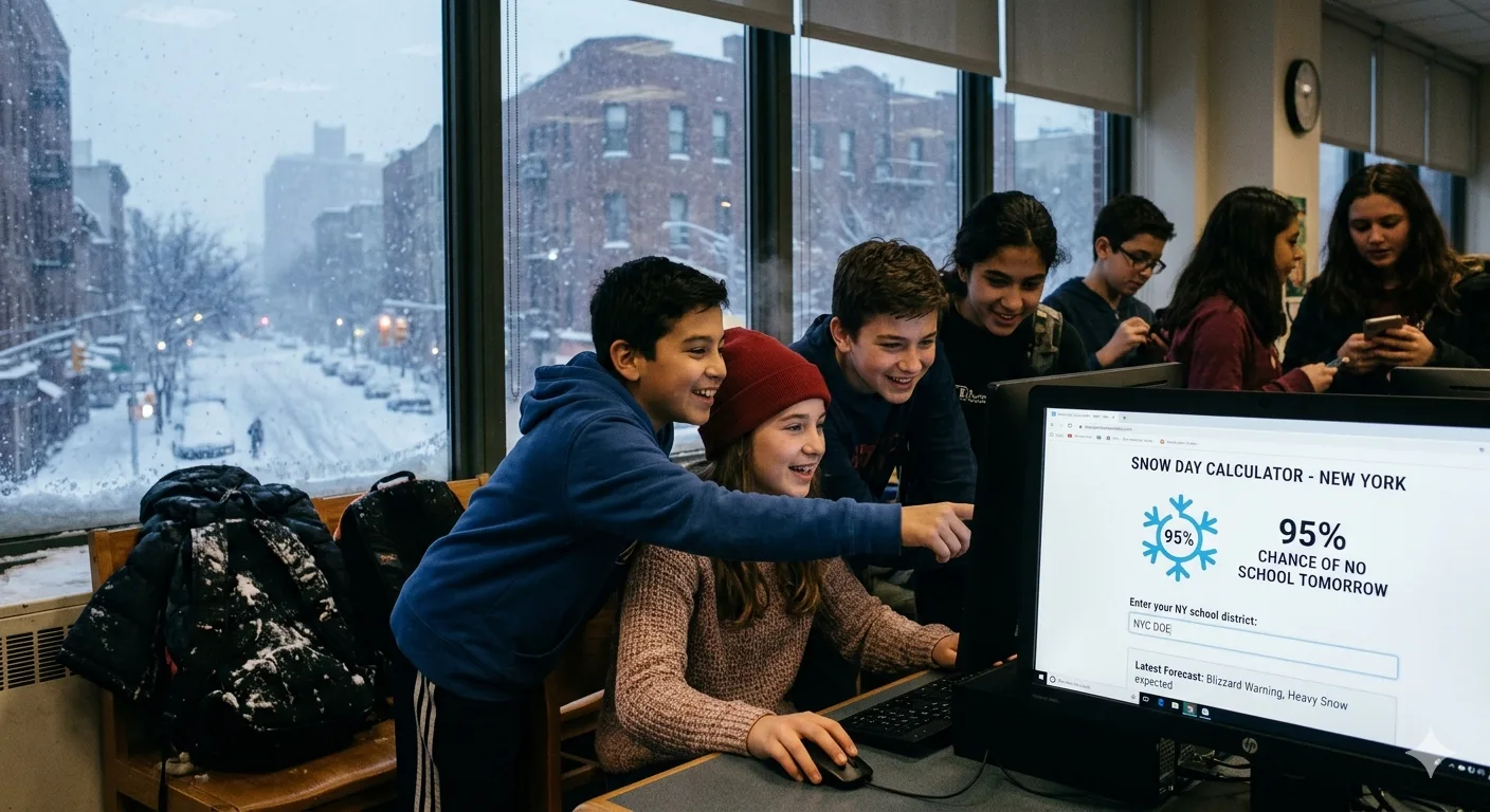
If you have ever wondered whether school will be cancelled tomorrow, you already know the anxious evening ritual: refreshing the weather app, checking the news ticker, and hoping for good news. A snow day calculator for New York can cut through that uncertainty with data-driven predictions tailored to your exact location.
But here is the catch: New York State is not one place when it comes to winter weather. The snow day experience in New York City is completely different from the experience in Buffalo, which is one of the snowiest cities in America. Understanding those differences, and knowing which calculator factors matter most in your region, is the key to getting an accurate prediction.
This guide breaks down how snow day calculators work, compares thresholds across the state from NYC all the way to Buffalo, explains the science behind lake-effect snow, and gives you a city-by-city playbook for winter 2025-2026.
New York City schools typically close with 3 to 5 inches of snow, while Buffalo schools routinely stay open through 7 to 10 inches unless whiteout or ice conditions develop. A single statewide calculator will almost always give you the wrong answer. Always use one calibrated to your specific region and school type.
What Is a Snow Day Calculator and How Does It Work?
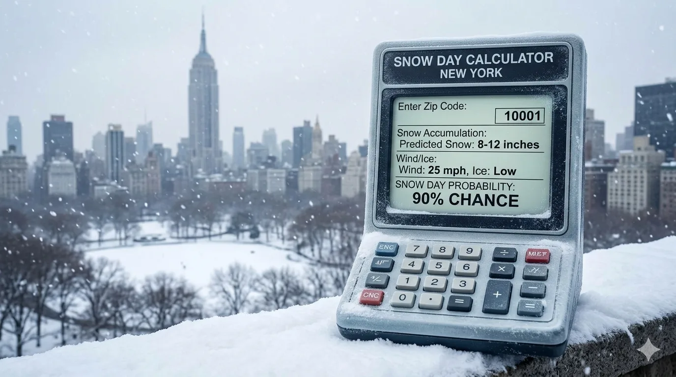
A Snow Day Calculator is a digital tool that analyzes real-time weather forecast data and combines it with historical school-closure behavior to produce a percentage probability that school will be cancelled tomorrow. The best tools do far more than look at a single snowfall number.
Key Factors Every Good Calculator Analyzes
- Expected snowfall accumulation and intensity (total inches AND how fast it falls)
- Ice and freezing rain probability (often more disruptive than snow depth alone)
- Wind chill and air temperature (extreme cold can trigger closures even without snow)
- Storm timing relative to morning commute (a storm peaking at 7 AM is far more disruptive than one ending at midnight)
- Forecast confidence level (a certain 4-inch forecast differs from a 50/50 chance of 4 inches)
- Road condition projections (plowing capacity and road treatment resources vary by municipality)
- School type (public districts, private schools, and universities follow different thresholds)
When Should You Check the Calculator?
For the most accurate snow day prediction in New York, check the calculator after 6:00 PM the evening before the potential storm. Weather models for your area become dramatically more reliable inside the 12-to-24-hour window. Most districts in New York announce closures between 5:00 AM and 6:00 AM on the morning of the event, so an evening check gives you the best available data without waiting until the last minute.
Pair your snow day calculator result with the National Weather Service hourly forecast for your ZIP code. The NWS hourly breakdown will show you exactly when precipitation is expected to peak, which is the single most important factor in a superintendent's closure decision.
NYC vs Buffalo: Why One Number Does Not Fit All of New York
The single biggest mistake people make when using a snow day calculator in New York is treating the state as a uniform region. It is not. The weather culture, infrastructure, and school-closure philosophy are radically different at opposite ends of the state.
🏮 New York City
Closes with 3 to 5 inches. Heavy reliance on public transit, buses, and walking routes in dense urban areas makes even moderate snow highly disruptive. The NYC Department of Education serves over 1 million students across five boroughs with vastly different microclimates.
🏠 Suburban NYC & Long Island
Moderately closure-prone. Suburban districts often close at 4 to 6 inches but weigh bus route conditions heavily. Private and charter schools in this area often close at even lower thresholds than public districts.
🥶 Buffalo & Upstate NY
Stays open through 7 to 10 inches in most cases. Robust plowing fleets, experienced drivers, and a community that has grown up managing heavy snow mean closures are reserved for truly severe events: whiteout conditions, ice storms, or extreme temperatures.
"Upstate NY cities like Buffalo, Syracuse, and Rochester rarely close thanks to robust plowing infrastructure, while NYC schools almost never close. Suburban districts fall in between and tend to be the most closure-prone zone in the state." Snow Day Chance (snowdaychance.com), 2025
The NYC School Closure Reality
New York City public schools have a notably high threshold for full closure. The school system serves over 1,800 schools across all five boroughs, and a citywide closure affects millions of parents, workers, and commuters. City officials typically declare a snow day only when the National Weather Service forecast and road condition reports align to indicate a genuine public safety risk.
A dramatic example: during the February 2026 blizzard, NYC Mayor Zohran Mamdani closed public schools only when 16 to 24 inches of snow was projected for the five boroughs, with a full travel ban declared on city streets from 9 PM Sunday through noon Monday. That was described as the city's first traditional snow day of the entire 2025-2026 winter, despite repeated storm events earlier in the season.
The Buffalo Mentality Toward Snow
Buffalo, on the other hand, operates in a completely different context. Buffalo averages approximately 85 inches of snow per year, far exceeding the US national average of 28 inches. The city has developed infrastructure, driver skills, and community norms around sustained heavy snowfall. Closing schools for every 6-inch snowfall would effectively shut down the city for months.
"Over half of Western New York's annual snowfall comes from lake-effect snow, which is very localized and can be extremely intense. NWS Buffalo meteorologists are recognized as experts in lake-effect snow forecasting precisely because of this complexity." NYSkiBlog Directory, NWS Buffalo Weather Forecast Office
Understanding Lake-Effect Snow: Buffalo's Defining Weather Force
To use a Buffalo snow day calculator effectively, you need to understand lake-effect snow. It is not like the widespread snowstorms that bring inches of snow evenly across a region. Lake-effect snow is hyperlocal, intense, and can dump feet of snow in a matter of hours while a town just 10 miles away sees nothing.
How Lake-Effect Snow Forms
Lake-effect snow develops when cold Arctic air masses sweep across the relatively warmer open water of Lake Erie and Lake Ontario. As cold air crosses the lake, it picks up vast amounts of moisture and heat. When this moisture-laden air reaches land, it rapidly rises and condenses into heavy snow bands.
- Lake Erie primarily affects Buffalo, Chautauqua, and Erie counties
- Lake Ontario primarily affects Syracuse, Oswego, and the Tug Hill Plateau
- The Tug Hill Plateau east of Lake Ontario is the snowiest populated area in the eastern United States
- Snow bands can be extremely narrow: sometimes just 5 to 10 miles wide but dropping snow at 2 to 4 inches per hour
- Lake Erie can freeze over in harsh winters, which reduces lake-effect intensity for Buffalo but extends the season for Lake Ontario-fed regions
Why Lake-Effect Snow Is Hard to Predict
Standard weather models struggle with lake-effect snow because the bands are so narrow and can shift position by just a few miles based on wind direction. A calculator using only ZIP-code-level data may miss whether your specific neighborhood sits inside or outside the primary snow band. This is why local NWS Buffalo forecasters issue highly specific lake-effect snow warnings that name individual towns and expected timing windows.
Always check the NWS Buffalo office directly for lake-effect snow statements. They specify which towns are in the primary snow band versus which will see lighter totals. This is far more accurate than any general statewide calculator for Western New York conditions.
New York State Annual Snowfall by City: A Visual Comparison
Note: Tug Hill Plateau figures represent annual peak accumulations in the heaviest snowbelt zones, per NWS Buffalo historical data.
School Closure Thresholds by School Type Across New York
Not all schools in New York follow the same closure rules. Understanding which category your school falls into is essential for using any snow day predictor accurately.
| School Type | NYC Threshold | Suburban NY Threshold | Buffalo / Upstate Threshold | Closure Likelihood |
|---|---|---|---|---|
| Public K-12 District | 3-5 inches + transit impact | 4-6 inches | 7-10 inches or ice/whiteout | Moderate |
| Private / Charter Schools | 2-4 inches (independent decisions) | 3-5 inches | 5-8 inches | Higher |
| Rural / Small Districts | N/A | 3-5 inches (hills and back roads key factor) | 5-8 inches (bus route terrain is decisive) | Highest |
| Colleges and Universities | Rarely close; require extreme conditions | Rarely close | Rarely close; no 2-hour delays issued | Lowest |
Why Rural Districts Close Earlier Than City Schools
Rural school districts in New York often make closure decisions first because their bus routes involve unpaved or lightly maintained back roads, steep hills, and long travel distances. A storm that the highway department has plowed clear by 5 AM may leave rural secondary roads dangerously icy for hours afterward. Rural superintendents frequently make closure calls by 4:30 AM based on conditions that urban administrators would consider manageable.
How to Use a Snow Day Calculator for New York: Step-by-Step
- Enter your ZIP code, not just your city. New York State has enormous weather variation within individual counties. Use your specific ZIP code so the calculator pulls hyperlocal forecast data.
- Select your school type. Public K-12, private school, and college closures follow different thresholds. Always choose the right category.
- Check after 6:00 PM the evening before. Weather model accuracy improves dramatically in the 12-24 hour window. Early morning checks the day before may show significantly different probabilities than an evening check.
- Look at the hourly breakdown, not just the daily total. A storm that deposits 5 inches but peaks between 11 PM and 4 AM, giving plows time to clear roads before bus pickup, is far less likely to cancel school than 3 inches falling during the morning commute window.
- Check the ice and freezing rain probability separately. Ice is routinely more disruptive than snow. Even 1-2 inches of snow preceded by a layer of freezing rain can freeze bus doors shut and make roads dangerous even after plowing.
- Cross-reference with the NWS forecast discussion. The NWS issues a daily Forecast Discussion (AFD) that explains meteorologist reasoning in plain language. This is free and invaluable for high-stakes decisions.
- Always follow your district's official channels. Use the calculator as a planning tool, never as a substitute for the official announcement from your school district, which will come via their website, app, or the local news.
New York Storm Types and How They Affect Snow Day Probability
Different storm types produce very different snow day outcomes in New York. Knowing which type is approaching helps you calibrate how seriously to take a forecast and what the calculator is actually measuring.
Nor'easters: The Classic NYC Snow Day Maker
Nor'easters are powerful coastal low-pressure systems that track northeastward up the Atlantic Seaboard. They bring heavy, wet snow to New York City, Long Island, and the Hudson Valley while often producing lighter totals upstate. Because Nor'easters affect metropolitan transit infrastructure and can combine heavy snow with strong winds, they are the most common cause of true NYC public school snow days. The February 2026 blizzard was a Nor'easter event.
Alberta Clippers: Fast and Light
Alberta Clippers are fast-moving systems originating in Canada. They move quickly across New York, bringing light to moderate snowfall but often significant wind and cold. Clippers rarely trigger school closures on their own but can leave roads icy and reduce visibility, occasionally leading to delayed openings rather than full closures.
Lake-Effect Events: Buffalo's Specialty
As described above, lake-effect snow events are highly localized and can be the most intense snow events any region experiences. Buffalo can receive feet of snow from a lake-effect band while Rochester, just 75 miles east, stays relatively clear. For Western New York snow day calculators, lake-effect band positioning is the most important variable.
"Lake-effect snow can intensify quickly and reduce visibility. Short bursts can create unsafe bus conditions even if snowfall totals vary widely by neighborhood. Local roads, terrain, plowing coverage, and timing can all differ within the same ZIP code." Snow Day Calculators IO (snowdaycalculators.io), 2026
New York City Snow Day Guide: What Makes NYC Different
New York City operates its school system at a scale that few places in the world can match. Understanding the unique factors that drive NYC school closure decisions makes any snow day calculator result for NYC far more meaningful.
The Public Transit Dependency Factor
Unlike suburban or upstate communities where students are bused from residential neighborhoods, a massive percentage of NYC students travel to school via subway, city bus, or on foot. When snow compromises MTA bus service with detours and curtailments, or when the subway runs modified express service on local tracks, the effective commute for both students and teachers becomes dangerous. This transit dependency is a primary reason even moderate snowfall can tip the scale toward closure in the five boroughs.
The Five Borough Microclimate Problem
New York City covers five distinctly different geographic boroughs. Staten Island typically receives more snow than lower Manhattan. The Rockaway Peninsula in Queens is vulnerable to coastal flooding as well as snow. The Bronx can experience heavier snow bands than Brooklyn in certain storm tracks. A single closure decision must accommodate all five boroughs simultaneously, which often means the threshold is set by the borough with the worst conditions.
Read More : Lake Effect Snow Explained
How the NYC DOE Announces Snow Days
The NYC Department of Education announces school closures through the following official channels:
- The NYC DOE website
- The NYC Schools Account (NYCSA) app notification system
- The Mayor's official press conferences and social media
- 311 NYC (portal.311.nyc.gov) school calendar and closures page
- Local TV and radio stations (NY1, ABC 7, NBC 4, CBS 2, WABC radio)
Buffalo Snow Day Guide: Living in America's Snowiest Major City
Buffalo, New York is not just accustomed to snow. It is built around snow. With an average of approximately 85 inches of snow per year, Buffalo residents develop a relationship with winter weather that most Americans never experience. This shapes how the community, schools, and local government respond to individual storm events.
Buffalo School District Closure Philosophy
The Buffalo City School District, like most Western New York districts, evaluates closure decisions based on bus route safety across the entire district, not just snowfall depth. Key decision factors include:
- Whether road treatment crews have had adequate time to pre-treat and plow primary bus routes
- Wind-driven whiteout conditions that reduce visibility regardless of accumulation depth
- Temperature drops below approximately 20 degrees Fahrenheit, which can refreeze treated roads quickly
- Ice accumulation beneath fresh snow, which is far more dangerous for buses than snow alone
- Lake-effect band positioning and whether the district falls inside the primary accumulation zone
Buffalo Snowfall by Month: Planning Your Winter
November marks the start of serious snow risk in Buffalo, with major lake-effect events most likely in late November and early December when Lake Erie is still open and cold Arctic air is most common. January and February see sustained snowpack and the most frequent closure-level events. March and April can still produce significant snowfall, though lake-effect intensity wanes as Lake Erie begins to partially ice over.
According to historical data compiled from NOAA's National Centers for Environmental Information, Buffalo's snowfall in heavy years during December alone can exceed 31 inches, while January figures in the most intense seasons have surpassed 35 inches.
The lake-effect season for Buffalo typically runs from mid-November through mid-January for Lake Erie-driven events. After Lake Erie freezes, Lake Ontario continues driving heavy lake-effect snow toward Syracuse and the Tug Hill Plateau well into March. If you are near the Lake Ontario snowbelt, your snow day season extends significantly longer than Buffalo's.
Regional Tips and Notes: From Long Island to the North Country
Long Island
Long Island schools follow patterns closer to NYC than upstate New York. Coastal Nor'easters can bring significant heavy, wet snow that is highly disruptive to the dense suburban road network. Long Island school districts tend to be more closure-prone than NYC public schools because they rely entirely on bus transport, which is acutely sensitive to road conditions.
Hudson Valley and Capital Region
The Hudson Valley and Albany-area districts experience a mix of coastal Nor'easter impacts and interior cold-air snow events. Albany averages approximately 48.6 inches of snow per year, nearly double New York City's average. Districts here are moderately aggressive about closures, particularly when ice forms over pavement before significant snowfall arrives.
Central New York (Syracuse Area)
Syracuse is one of the snowiest major cities in America, often exceeding 120 to 130 inches of snow per year from Lake Ontario-driven lake-effect events. The Tug Hill Plateau just east of Syracuse regularly receives 200 or more inches in a single season, making it the snowiest populated zone in the eastern United States. Syracuse-area districts have exceptionally high closure thresholds as a result.
North Country (Adirondacks and St. Lawrence Valley)
The Adirondack Mountain region and the St. Lawrence Valley receive heavy snowfall from multiple storm tracks, including direct Nor'easters, lake-effect snow from both Lake Ontario and Lake Champlain, and upslope enhancement from the Adirondack terrain. These districts make closure decisions based on road condition reports that prioritize rural mountain routes with steep grades and limited plowing resources.
Conclusion
A snow day calculator for New York is an indispensable planning tool for families, educators, and anyone navigating a New York State winter. But to get value from it, you must use one calibrated to your specific region, school type, and the unique storm patterns that affect your area.
New York City and Buffalo represent opposite ends of the snow-day spectrum. NYC closes cautiously, balancing a million-student system against transit infrastructure and borough-wide safety. Buffalo endures what most Americans would consider historic snowfall events as a matter of routine, closing schools only when conditions reach genuinely dangerous levels.
Between those poles lies the full diversity of New York State winter weather: suburban Long Island districts, lake-effect snowbelts around Syracuse, Adirondack mountain roads, and Hudson Valley ice storms. No single number and no single calculator covers all of it.
Use the best available tools, check them at the right time, combine them with official NWS data for your ZIP code, and always follow your district's official announcement. When the forecast shows anything close to the edge, err on the side of safety. New York winters are serious, but they are also navigable when you have the right information.
Also Checkout :