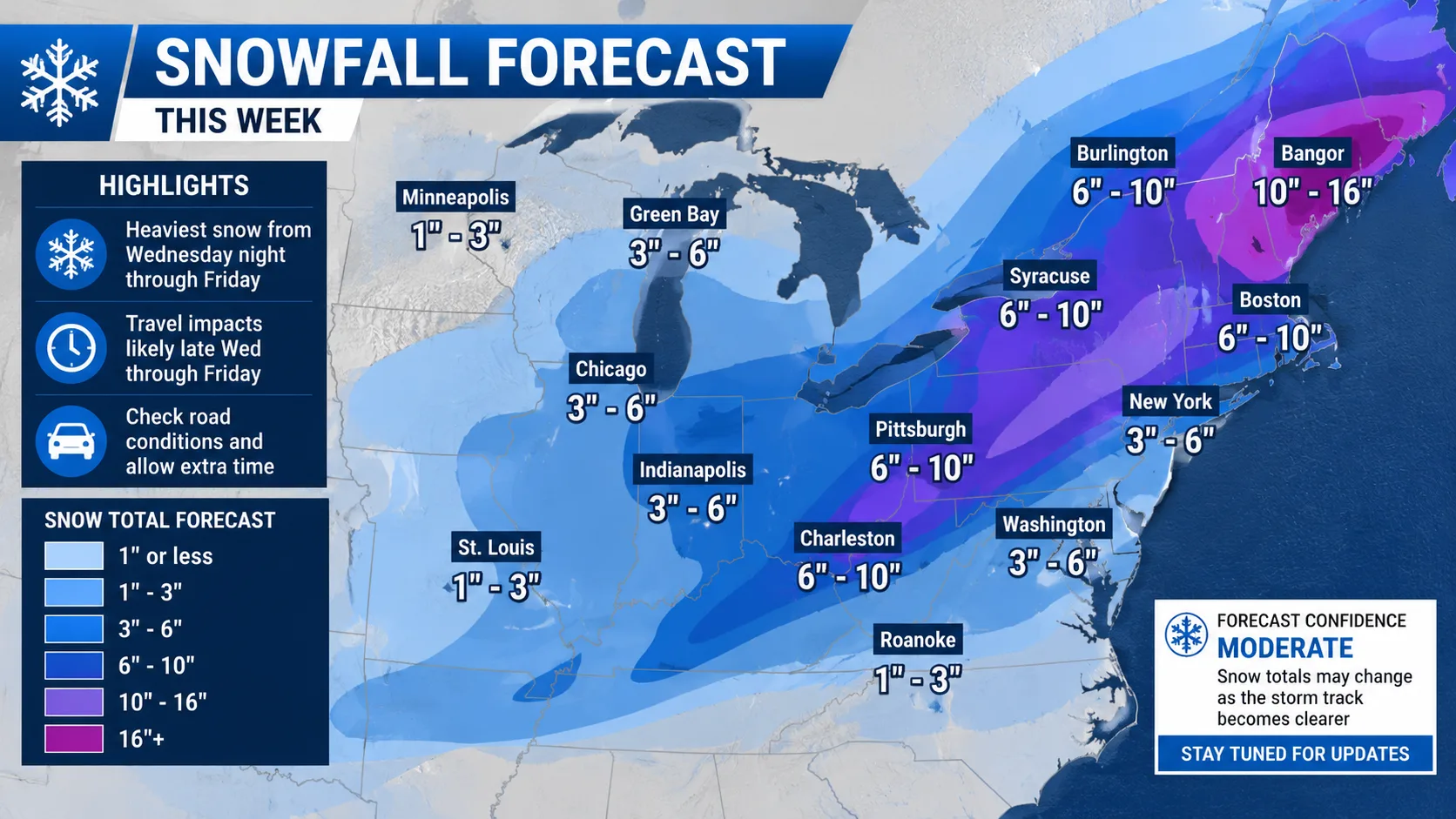
Checking the snowfall forecast this week should be simple, but most forecast pages either overload you with raw data or oversimplify it so much that you cannot actually plan your week around it. This guide fixes that.
Below, you will learn exactly how weekly snowfall forecasts are built, how to read them like a meteorologist, which tools give the most accurate weekly snow predictions, and how to avoid the most common forecasting mistakes people make every winter.
Key takeaway: A snowfall forecast this week is only as useful as your ability to interpret probability, timing, and accumulation ranges together. Reading just one number (like "6 inches") without the confidence range and timing window is the single biggest reason people get caught off guard.
1. What Is a "Snowfall Forecast This Week"?
A weekly snowfall forecast is a short-range to medium-range weather prediction that estimates how much snow is likely to fall in a specific location over the next 5 to 7 days. Unlike a single-day forecast, a weekly outlook has to account for multiple weather systems, temperature swings, and changing storm tracks.
Weekly snow forecasts typically include:
- Daily accumulation estimates (in inches or centimeters)
- Probability of snowfall for each day
- Timing windows (morning, afternoon, overnight)
- Temperature trends that affect snow type and melt rate
- Storm track confidence, which tells you how reliable the forecast actually is
2. How Weekly Snowfall Forecasts Actually Work
Meteorologists do not simply "predict" snow. They run multiple computer weather models, compare outputs, and adjust for local terrain and historical patterns. Understanding this process helps you judge how much to trust a forecast.
2.1 The Main Weather Models Used
| Model | Best For | Forecast Range | Typical Reliability |
|---|---|---|---|
| GFS (Global Forecast System) | Broad weekly trends | Up to 16 days | Moderate, drops after day 5 |
| ECMWF (European Model) | Storm track accuracy | Up to 10 days | High, especially days 1 to 7 |
| NAM (North American Mesoscale) | Short-term local detail | Up to 3 days | High for days 1 to 2 |
| HRRR (High-Resolution Rapid Refresh) | Hour-by-hour accuracy | Up to 18 hours | Very high, near-term only |
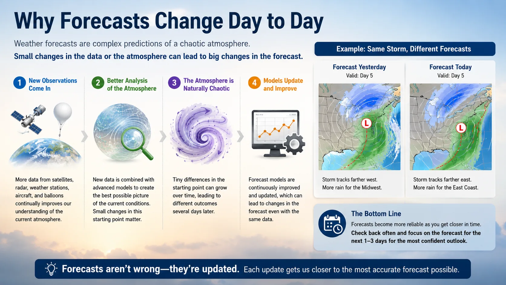
Most reliable snowfall forecast pages blend several of these models together, which is why forecasts often shift slightly every 6 to 12 hours as new model data comes in.
2.2 Why Forecasts Change Day to Day
It is normal to see a forecast for "8 inches" on Monday shrink to "4 inches" by Wednesday. This is not a mistake. It reflects updated model runs, and it is exactly why checking your snowfall forecast this week more than once matters, especially 48 hours before an expected storm.
3. Search Intent: What People Actually Want When They Search This
Most searches for a weekly snow forecast fall into three groups:
- Immediate planning "Will it snow enough to cancel school or work this week?"
- Travel decisions "Should I drive, fly, or delay a trip?"
- Outdoor activity planning "Is this a good week for skiing, shoveling prep, or snow removal scheduling?"
A genuinely helpful forecast page needs to answer all three, not just show a seven-day icon strip.
4. How to Read a Weekly Snowfall Forecast Correctly
4.1 Understand Accumulation Ranges
Forecasts often show a range, such as "3 to 6 inches," instead of one number. This range reflects real uncertainty. Always plan around the higher end of the range if you have flexible plans, and the lower end only if your plans are low-risk.
4.2 Check the Confidence Level
Look for words like "likely," "possible," or "isolated." These directly reflect probability:
- Likely (70 percent or higher): High confidence, plan accordingly
- Possible (40 to 69 percent): Moderate confidence, have a backup plan
- Isolated or slight chance (under 40 percent): Low confidence, monitor updates
4.3 Watch the Timing Window, Not Just the Day
A forecast might say "snow Thursday," but the real question is whether it falls during your morning commute or overnight while you sleep. Always check hourly breakdowns for the specific day that affects your plans.
5. Weekly Snowfall Outlook: Example Breakdown
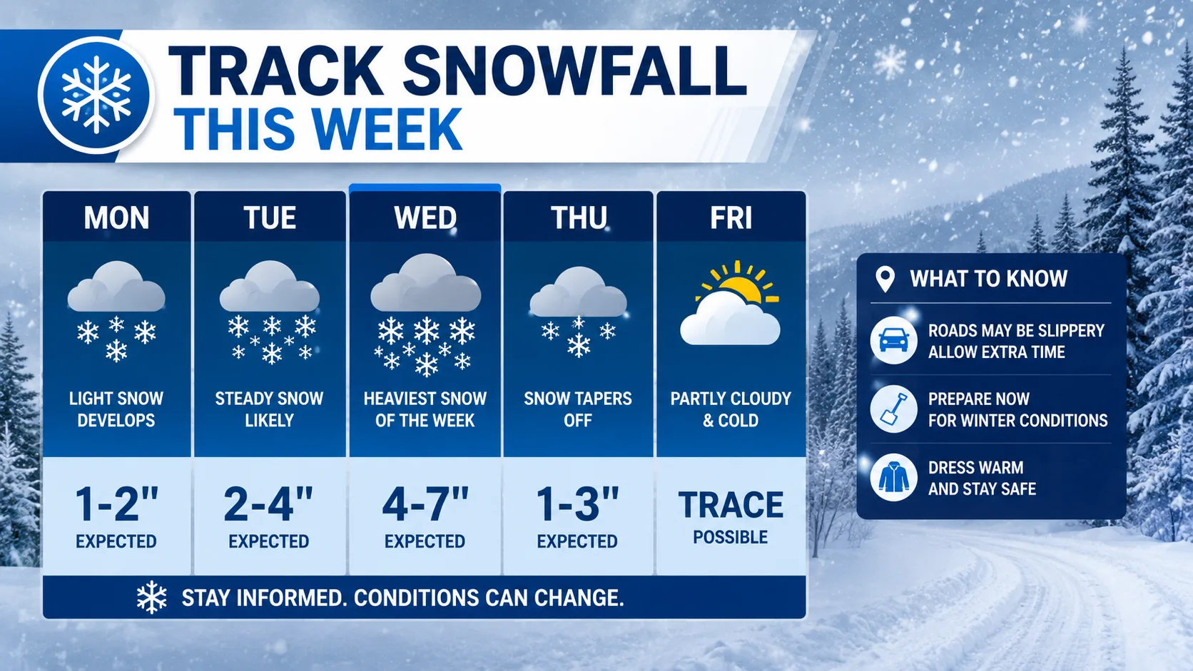
Here is an example of how a well-structured weekly snowfall forecast should look. This is a sample format, not a live forecast, since actual snowfall depends entirely on your specific location and the current week's weather pattern.
| Day | Snow Chance | Expected Accumulation | Timing | Notes |
|---|---|---|---|---|
| Monday | 10% | 0 in | — | Clear, cold |
| Tuesday | 30% | Trace | Evening | Light flurries possible |
| Wednesday | 65% | 1 to 3 in | Overnight | Roads may be slick by morning |
| Thursday | 80% | 4 to 7 in | Morning through afternoon | Main storm day, plan around this |
| Friday | 40% | 0 to 1 in | Early morning | Lingering snow showers |
| Saturday | 15% | 0 in | — | Clearing, colder |
| Sunday | 10% | 0 in | — | Sunny, melt begins |
6. Snowfall Trend Visualization
Below is a simplified accumulation trend based on the example week above, showing how daily snowfall typically builds toward a peak storm day before tapering off:
Snowfall (inches)
7 |                       ■■■■
6 |                       ■■■■
5 |                       ■■■■
4 |                       ■■■■
3 |              ■■■
2 |              ■■■
1 |      ■              ■■■     ■
0 |■■   ■■   ■■   ■■   ■■■   ■■   ■■
  Mon  Tue  Wed  Thu  Fri  Sat  Sun
This is the classic shape of a single-storm weekly pattern: a gradual buildup, one peak accumulation day, then a tapering trend. Multi-storm weeks will show two separate peaks instead of one.
7. Tools You Can Use to Track Snowfall This Week
- National weather service sites for official, region-specific alerts and watches
- Interactive radar tools to see real-time snow bands as they move
- Model comparison sites that show GFS vs ECMWF side by side
- Local news meteorologist forecasts, which often adjust national models using local terrain knowledge
According to the National Weather Service, forecast accuracy for precipitation type and amount drops significantly beyond the 5 to 7 day window, which is why relying on multiple updated sources during the week itself produces far better results than trusting a single forecast issued days in advance.
8. Common Mistakes People Make Reading Weekly Snow Forecasts
- Trusting the 7-day forecast as final instead of rechecking closer to the event
- Ignoring probability percentages and only looking at the accumulation number
- Confusing "chance of snow" with "chance of accumulating snow", which are different measurements
- Not checking elevation differences, since snowfall can vary by several inches within a short driving distance
- Overlooking wind forecasts, which affect drifting and visibility even when accumulation is low
As one veteran broadcast meteorologist commonly puts it in winter briefings, the biggest forecasting error is not model inaccuracy, it is the public reading a single number in isolation instead of the full probability picture.
Read More : Snow Day Calculator Montreal
9. How to Plan Your Week Around the Snow Forecast
9.1 For Commuters
Check the hourly breakdown for your commute window specifically, not just the daily summary.
9.2 For Travelers
Book flexible travel dates around your highest-confidence storm day rather than avoiding the whole week.
9.3 For Outdoor Work and Snow Removal
Use the accumulation range's upper bound to schedule equipment and staffing, since underestimating snow load causes far more disruption than overestimating it.
10. Conclusion
A reliable snowfall forecast this week is not about finding one perfect number. It is about understanding accumulation ranges, probability, timing windows, and how forecasts evolve as the week progresses.
Use a 7-day outlook for early awareness, shift to hourly and 48-hour forecasts as your event approaches, and always cross-check at least two sources before making firm plans. Following this approach will make you far more prepared than someone simply glancing at a single snowflake icon on a weather app.
Also Checkout :