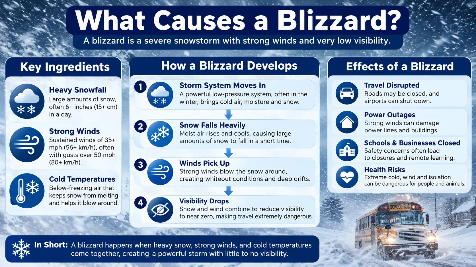
What causes a blizzard comes down to three ingredients meeting at once: cold air, available moisture, and a strong lifting force, combined with a steep pressure gradient that whips those conditions into sustained, powerful wind. Officially, a storm only earns the name blizzard when winds reach 35 mph or higher, visibility drops below a quarter mile, and those conditions last for at least three hours.
This guide breaks down exactly how those ingredients come together, why some storms turn into blizzards while others do not, and how to check your area's winter storm risk using our winter weather tools the next time conditions start to look dangerous. Whether you are a parent deciding if it's safe to drive to school, a commuter watching a forecast escalate, or just curious about the science behind the storm, understanding these ingredients makes the next blizzard warning far easier to interpret.
What Is a Blizzard?
A blizzard is a winter storm with sustained winds or frequent gusts of 35 mph or greater, combined with visibility of a quarter mile or less, lasting for at least three consecutive hours. This is the official criteria used by the National Weather Service to distinguish a blizzard from an ordinary snowstorm.
Notice what is missing from that definition: a specific snowfall total. That surprises a lot of people, so it is worth repeating.
- Heavy snowfall is common during blizzards, but it is not required for the official classification
- Wind speed and visibility are the deciding factors, not inches on the ground
- Duration matters too, since a brief burst of high wind and snow does not qualify on its own, no matter how intense that burst feels in the moment
This is why a "ground blizzard," where little or no new snow is falling but existing snow is being whipped off the ground by high wind, can still meet the official blizzard threshold even under a clear sky.
What Causes a Blizzard?
Every blizzard forms from the same basic recipe: cold air, moisture, and lift, combined with a pressure difference strong enough to generate sustained high wind. Remove any one ingredient and the storm either weakens or never becomes a blizzard in the first place.
The Three Essential Ingredients
Meteorologists sometimes describe these three factors as a recipe, since removing any single one prevents the storm from developing the way it otherwise would.
- Cold air: Without air cold enough, typically at or below freezing through a deep layer of the atmosphere, precipitation falls as rain instead of snow.
- Moisture: Oceans, the Gulf of Mexico, and the Great Lakes all supply the water vapor that becomes snow. No moisture source means no snow, regardless of how cold the air is.
- Lift: Air needs a mechanism to rise, cool, and condense into precipitation. Weather fronts, mountains, and low-pressure systems all provide this lift.
When these three ingredients come together with enough intensity, they set the stage for heavy snowfall. But snowfall alone does not make a blizzard. That requires one more piece: wind.
The Pressure Gradient and Where the Wind Comes From
Blizzards form when a strong area of low pressure sits close to an area of high pressure. Air naturally moves from high pressure toward low pressure, and the steeper that pressure difference, called the pressure gradient, the faster the air moves.
Think of it like a hill. A gentle slope produces a slow trickle of air, while a steep drop sends air rushing downhill fast. A tight pressure gradient between a deep low and a strong high produces exactly that kind of steep drop, and the result is sustained, powerful wind.
Bombogenesis and Rapidly Strengthening Storms
Some of the most dangerous blizzards form through a process called bombogenesis, where a storm's central pressure drops extremely fast, typically at least 24 millibars in 24 hours. Meteorologists sometimes refer to storms that intensify this quickly as bomb cyclones.
This rapid pressure drop steepens the pressure gradient almost overnight, which can turn a routine winter storm into a full blizzard in a matter of hours rather than days.
Not every rapidly intensifying storm becomes a blizzard everywhere it travels, though. The strongest winds and heaviest snow are usually concentrated in a specific quadrant of the storm, often the northwest side relative to the storm's center, which is why one town can experience full blizzard conditions while a town just a hundred miles away sees a much calmer winter storm from the same system.
The Role of the Jet Stream
High above the surface, a fast-moving ribbon of air called the jet stream steers most winter storms across North America. When the jet stream dips far south, it can pull Arctic air down into the middle of the country while simultaneously drawing warm, moist air northward from the Gulf of Mexico or the Atlantic.
The boundary where these two very different air masses meet becomes prime territory for blizzard development. A jet stream pattern that stays locked in this configuration for several days can produce back-to-back blizzard-producing storms across the same region.
How a Blizzard Forms, Step by Step
While every storm is different, most blizzards follow a similar sequence of stages as they develop and intensify.
- Warm, moist air meets cold, dry air. This typically happens where a cold front from the north collides with warmer air moving up from the south or off the ocean.
- A low-pressure center begins to form. Along the boundary between these air masses, air starts to rise and rotate, creating an organized area of low pressure.
- The pressure gradient tightens. As the low deepens, the pressure difference between it and nearby high pressure increases, accelerating the wind.
- Snow production ramps up. Rising air along the storm's fronts cools rapidly, condensing moisture into heavy snow bands.
- Wind and snow combine into whiteout conditions. Once sustained winds reach 35 mph with visibility under a quarter mile, the storm officially crosses into blizzard territory.
- The storm gradually weakens. As the pressure gradient relaxes and the storm moves away or fills in, wind speeds drop and visibility improves.
You can check where a developing storm stands against these stages using the tools in our calculator directory, which track live wind, snow, and visibility conditions for your area.
It is worth noting that not every storm makes it through all six stages. Many low-pressure systems produce heavy snow without ever generating winds strong enough to meet the blizzard threshold, which is exactly why forecasters distinguish carefully between a routine winter storm warning and a full blizzard warning.
Types of Blizzards
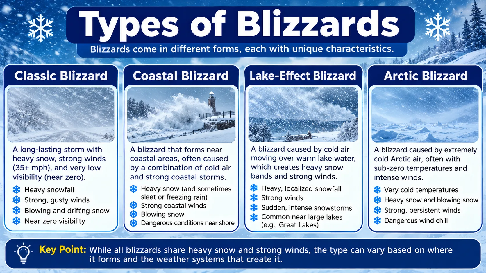
Not every blizzard forms the same way. Understanding the different types helps explain why some regions see them far more often than others.
Synoptic Blizzards
These are the large, classic blizzards driven by a major low-pressure system, often a nor'easter along the East Coast or an Alberta Clipper moving through the Plains and Midwest. They typically affect a wide area and are well forecast days in advance.
Lake-Effect Blizzards
Around the Great Lakes, cold air moving over relatively warm lake water picks up huge amounts of moisture. When wind speeds are high enough, this localized snow band can intensify into a full blizzard on the downwind shore, even while areas just a short distance away stay clear.
Ground Blizzards
A ground blizzard happens when little or no new snow is falling, but strong wind, often following an Arctic cold front, picks up loose snow already on the ground. Visibility can drop to near zero even under a clear sky, which makes ground blizzards especially dangerous because they can catch drivers off guard.
Ground blizzards are most common across open, flat terrain such as the Northern Plains and parts of the Midwest, where there are few trees or buildings to block the wind. A layer of fresh, loose, unpacked snow combined with a fast-moving cold front is often all it takes to trigger one, even days after the original snowfall event has ended.
Nor'easters and Coastal Blizzards
Along the East Coast, blizzards frequently form as nor'easters, storms that pull moisture from the Atlantic Ocean while a strong high-pressure system sits to the north. That setup produces the classic combination of heavy snow and powerful onshore wind that can affect major cities from the Mid-Atlantic through New England in a single event.
These storms often undergo bombogenesis just offshore, intensifying rapidly as they track up the coast, which is one reason coastal blizzard warnings can escalate quickly even when an earlier forecast called for a more modest winter storm.
Alberta Clippers and Plains Blizzards
Fast-moving storms known as Alberta Clippers originate in western Canada and race across the Northern Plains and Midwest. On their own, clippers often produce only light to moderate snow. But when a clipper interacts with a reinforcing shot of Arctic air behind it, the resulting pressure gradient can generate the sustained high winds needed to create a blizzard across open, exposed terrain.
Why Understanding Blizzard Causes Matters
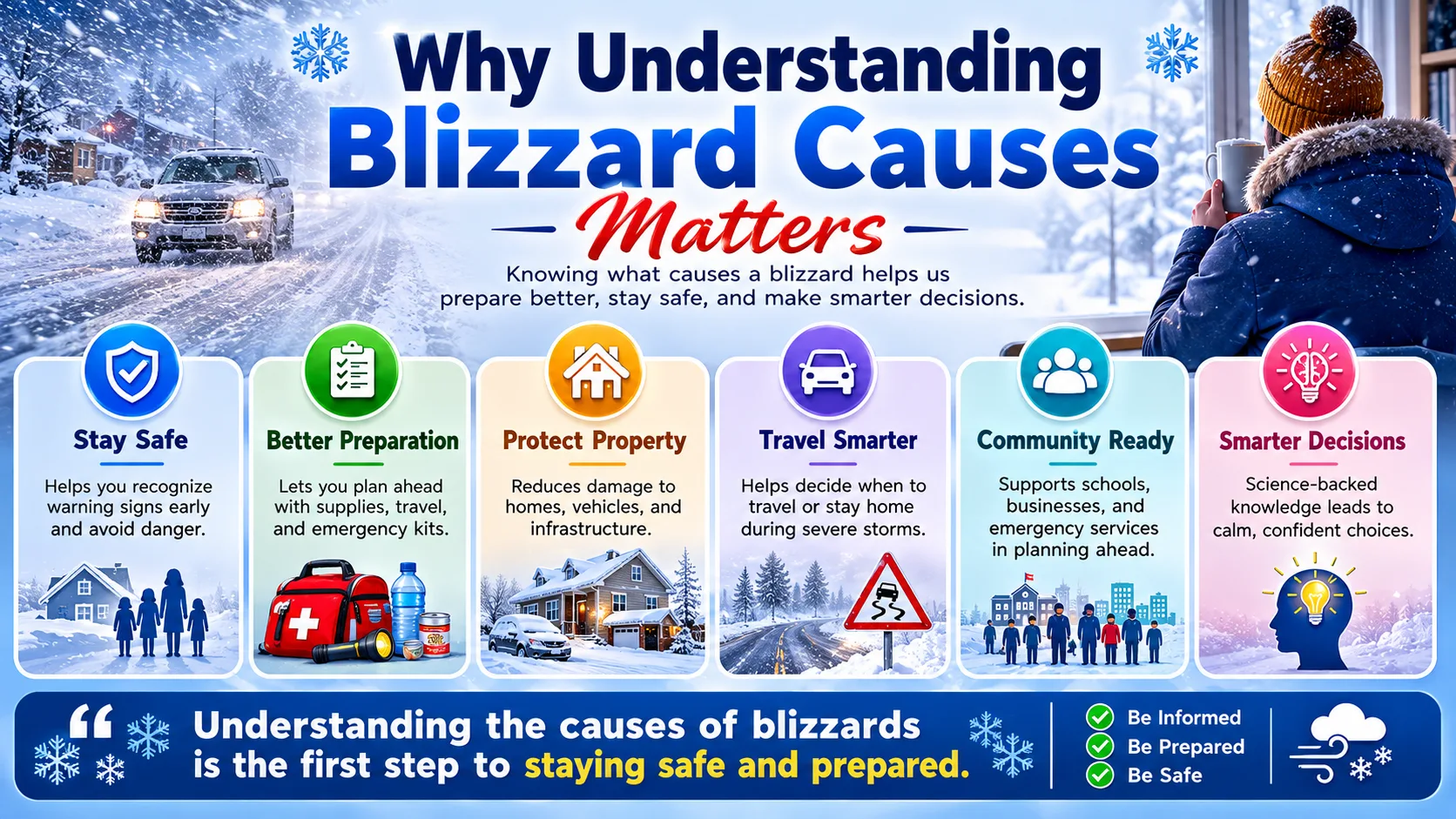
Knowing what actually causes a blizzard is not just an interesting science fact. It shapes real decisions for families, drivers, and communities.
- Safer travel decisions: Recognizing pressure gradient warning signs and rapid storm intensification helps drivers avoid getting caught in a sudden whiteout.
- Better emergency preparedness: Understanding that a ground blizzard can strike under clear skies helps people take wind warnings as seriously as snow forecasts.
- More accurate expectations: Knowing that snowfall totals alone do not define a blizzard prevents people from dismissing a dangerous high-wind, low-snow event.
- Smarter regional awareness: Understanding lake-effect and coastal blizzard patterns helps residents in those zones prepare earlier than a generic national forecast might suggest.
This knowledge also helps explain why a blizzard warning in one part of the country can look so different from one in another. A blizzard warning in coastal New England often comes with heavy, wet snow and coastal flooding risk, while the same warning across the Dakotas might involve very little new snow at all, just relentless wind driving existing snow into deep drifts across the highway.
This understanding pairs naturally with checking a live forecast. Once you know what to look for, a quick check of your state-by-state predictions page can tell you whether the ingredients for a blizzard are lining up in your area.
Real-World Examples: Blizzard Criteria by the Numbers
Official blizzard thresholds vary slightly by country, but they all center on the same core idea: strong sustained wind combined with poor visibility.
| Region / Authority | Minimum Wind Speed | Maximum Visibility | Minimum Duration |
|---|---|---|---|
| United States (National Weather Service) | 35 mph | Quarter mile | 3 hours |
| Canada (Environment Canada) | 25 mph (40 km/h) | Roughly a quarter mile (400 meters) | Sustained conditions |
| Bomb cyclone threshold | Not wind-based | Not applicable | 24 millibar pressure drop in 24 hours |
Notice that the bomb cyclone threshold measures something completely different: how fast a storm's pressure drops, not its wind speed directly. A storm can undergo bombogenesis without ever producing blizzard conditions everywhere in its path, since the strongest winds and heaviest snow are usually concentrated on one side of the storm.
Common Misconceptions and Pro Tips
Common Misconceptions About Blizzards
- "A blizzard means heavy snowfall." Wind and visibility, not snowfall totals, define a blizzard. A storm with only a couple of inches of snow can still qualify if the wind is strong enough.
- "Blizzards only happen during active snowstorms." Ground blizzards can occur under clear skies when wind picks up existing snow from the ground.
- "A blizzard warning and a winter storm warning mean the same thing." A blizzard warning specifically requires the wind and visibility criteria, while a winter storm warning is based mainly on expected snow or ice accumulation.
- "Bombogenesis always causes a blizzard." Rapid pressure drops make dangerous storms more likely, but the specific wind and visibility thresholds still have to be met in a given location.
- "Once the snow stops, the danger has passed." Wind can continue to create whiteout conditions for hours after snowfall ends, especially in open terrain prone to ground blizzards.
Pro Tips for Staying Safe
- Take ground blizzard warnings as seriously as snowing blizzard warnings. Clear skies do not guarantee safe visibility if wind is strong and snow is already on the ground.
- Watch for rapidly dropping pressure in forecasts. A storm described as undergoing bombogenesis deserves extra caution, even if the snow total looks moderate.
- Check wind chill alongside wind speed. Use our wind chill calculator to understand how dangerous the cold will actually feel during high winds.
- Avoid unnecessary travel once a blizzard warning is issued. Visibility under a quarter mile makes driving genuinely dangerous, regardless of how familiar the road is.
- Keep an emergency kit in the car during blizzard season. Extra layers, a flashlight, and a phone charger can matter far more than they seem to on a calm afternoon.
Read More : Winter Weather Forecast 2026
Blizzard vs. Other Winter Storm Terms
| Term | Defining Factor | Typical Duration | Key Danger |
|---|---|---|---|
| Blizzard | Wind 35+ mph and visibility under a quarter mile | 3+ hours | Whiteout conditions, extreme cold |
| Winter storm | Significant snow or ice accumulation | Varies, often 12 to 48 hours | Heavy snow load, slick roads |
| Snow squall | Brief, intense burst of snow and wind | Usually under an hour | Sudden zero-visibility whiteouts |
| Ground blizzard | Wind-driven existing snow, minimal new snowfall | Hours, often after a cold frontal passage | Whiteout with no active snowfall to explain it |
Understanding these distinctions helps you interpret alerts correctly instead of assuming every winter storm term describes the same level of danger. For a deeper look at how forecasters build these outlooks, see our full blog for related winter weather explainers, and check our calculator directory to track live wind and snow conditions during an active storm.
None of these definitions are meant to replace an official warning from your local weather service. They are meant to help you understand what that warning actually implies, so you can respond appropriately rather than treating every winter alert the same way.
Conclusion
What causes a blizzard ultimately comes down to a precise mix of cold air, moisture, lift, and a pressure gradient strong enough to generate sustained, dangerous wind. Snowfall totals matter less than most people assume, while wind speed and visibility are what actually define the storm.