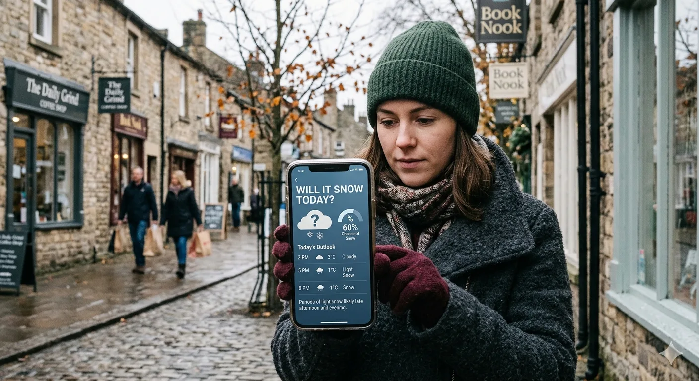
Will it snow today? It is one of the most searched weather questions every winter, typed by commuters, parents, skiers, and curious minds around the world. Whether you are hoping for a snow day or dreading an icy commute, this guide gives you every real-time tool, app, map, and expert tip you need to know exactly what is falling from the sky right now.
Why Checking Today's Snow Forecast in Real Time Matters
Snow is not like rain. A snowfall of even two inches can close schools, delay flights, make roads treacherous, and cancel outdoor plans. Yet small changes in temperature or storm track can mean the difference between six inches of powder and nothing at all. This is why checking a forecast from this morning is rarely good enough; you need real-time data.
Real-time snow tracking allows you to see live radar imagery, hourly precipitation probabilities, and up-to-the-minute ground reports, all updated every few minutes. This level of precision simply was not available to the public a decade ago. Today, with the right tools, you can watch a snow band move across your county on your phone in real time.
The Science Behind Snowfall: What Conditions Create Snow Today
Before diving into tools, it helps to understand what conditions you are actually tracking. Knowing the science helps you interpret forecasts more intelligently rather than just reading a number off a screen.
Temperature at All Layers of the Atmosphere
Snow forms when air temperatures at cloud level and at the surface are both at or below 32°F (0°C). However, the temperature profile through the entire atmospheric column matters. If air warms above freezing partway down, snowflakes melt into rain or sleet before reaching the ground. This is why a forecast can say "32°F at the surface" and you still get rain instead of snow; the air in between was too warm.
Moisture and Atmospheric Humidity
Snow requires sufficient atmospheric moisture. When water vapor rises and cools, it freezes around microscopic particles called ice nuclei, which can be dust, pollen, or sea salt particles. These ice crystals grow, collide, and eventually become snowflakes heavy enough to fall. Without adequate humidity, the sky stays clear even in freezing temperatures.
Storm Track and Low-Pressure Systems
Most significant snowstorms in the Northern Hemisphere are tied to low-pressure systems. Snow typically falls to the north and northwest of the low's center. A shift of even 50 to 100 miles in the storm track can move the heaviest snow bands from one city to a neighboring one, which explains why snowfall forecasting remains notoriously difficult even with modern models.
Snow is much more tricky to forecast than rain, because small details can have major effects on how a snow system develops. If the weather models get any of these details wrong, it can drastically change the forecast.
Forest Preserve District of Will County, citing the Weather Channel and National Weather ServiceThe Snow-to-Liquid Ratio
Not all snow is the same. Wet, heavy snow has a snow-to-liquid ratio of around 8:1 (8 inches of snow per inch of liquid). Dry, fluffy powder can reach 20:1 or even higher. This ratio determines how deep the accumulation will be from a given amount of moisture in the storm, and forecasters must estimate it for every event.

How to Check If It Will Snow Today: Step-by-Step Methods
There are multiple reliable methods for checking a real-time snow forecast. Here is how to use each one effectively.
Open an app like Weather.com, AccuWeather, or RadarScope. Switch the radar layer to show precipitation type. Blue or purple shading typically indicates snow. Watch the animation loop to see which direction the precipitation is moving and whether it is heading toward your area.
Go to weather.gov and enter your zip code or city. The NWS provides official hourly forecasts, winter storm warnings, and probabilistic snowfall maps updated multiple times per day by trained meteorologists.
Apps like Apple Weather, Google Weather, and AccuWeather offer push notifications for winter precipitation. Enable these in your settings so you receive an alert the moment snow is detected or officially forecast for your location.
Platforms like Weather Underground use a network of citizen-owned personal weather stations. Search for stations in your neighborhood to see real reported temperatures, wind, and precipitation happening within a mile of your home.
Advanced users can compare the American GFS model vs. the European ECMWF model at sites like Pivotal Weather or Tropical Tidbits. When both models agree, confidence is higher. When they diverge significantly, treat the forecast with more caution.
Best Real-Time Snow Forecast Tools and Apps in 2025
Not all weather apps are created equal when it comes to snowfall. Some are designed for casual users; others provide the same data that professional forecasters rely on. Here is a full breakdown of the best options available right now.
National Weather Service (NWS) Free, Official, and Authoritative
The National Weather Service at weather.gov is the gold standard for official U.S. snow forecasts. It provides hourly point forecasts, probabilistic snowfall totals, winter storm watches and warnings, and official snow band maps. The NWS is the source that all major media outlets and commercial apps ultimately draw from.
AccuWeather Best for Minute-by-Minute Precision
AccuWeather's proprietary MinuteCast feature provides minute-by-minute precipitation forecasts for the next two hours, telling you exactly when snowfall will start and stop at your precise location. It is one of the most useful real-time tools for people who need to plan by the hour.
Weather Underground Best for Hyperlocal Data
Weather Underground aggregates data from a global network of over 250,000 personal weather stations. This makes it exceptional for hyperlocal reporting. If your neighborhood is in a geographic low spot that gets more snow than surrounding areas, Weather Underground will likely show that where other apps will not.
OpenSnow Best for Mountain and Backcountry Snow
For skiers, snowboarders, and mountain enthusiasts, OpenSnow is the industry benchmark. It combines multiple numerical weather models, uses a proprietary mountain-optimized forecast system called PEAKS, and delivers daily written forecasts from expert local meteorologists. According to its own verification data, 5-day aggregate snowfall forecasts at major Western U.S. ski resorts achieved roughly 98% accuracy during select events in early 2025.
The Weather Channel App Best for General Users
The Weather Channel's app offers a clean, beginner-friendly interface with strong radar coverage, snow depth overlays, and winter weather alerts. Its "Winter Ready" dashboard during storm events consolidates snowfall totals, road conditions, and timing into a single screen.
Snow-Forecast.com Best for Global Ski Resort Tracking
Running for nearly three decades, Snow-Forecast.com provides mountain-level snowfall predictions at multiple elevations for ski resorts worldwide. Ed Leigh, BBC Ski Sunday commentator, has described it as the first and last website he checks every day when planning filming windows.
| App / Tool | Best For | Update Frequency | Cost | Platforms |
|---|---|---|---|---|
| National Weather Service | Official U.S. forecasts & warnings | Every 1-3 hrs | Free | Web |
| AccuWeather | Minute-by-minute precision | Real-time (minutely) | Free Premium | iOS, Android, Web |
| Weather Underground | Hyperlocal station data | Real-time | Free | iOS, Android, Web |
| OpenSnow | Mountain snow & ski resorts | 1-3 hrs + daily forecasts | Free Premium | iOS, Android |
| The Weather Channel | General winter weather | Real-time | Free | iOS, Android, Web |
| Snow Day Calculator | Minute-by-minute precision | Real-time | Free Premium | iOS, Android, Web |
| RadarScope | Professional radar analysis | Real-time radar | Paid | iOS, Android, Web |

How to Read a Live Snow Radar Map
A live radar map is one of the single most powerful tools for answering "will it snow today?" but it only helps if you know how to read it correctly.
Understanding Precipitation Type Colors
Most radar apps use a dual-polarization color scheme to distinguish precipitation types. Here is what the standard colors mean:
- Blue or light blue: Snow or frozen precipitation
- Purple or pink: Mixed precipitation, sleet, or freezing rain
- Green: Light to moderate rain
- Yellow/orange/red: Heavy rain or severe storms
When you see a wide swath of blue moving toward your location on an animated radar loop, that is real-time confirmation that snow is approaching.
Checking Radar Intensity and Coverage
Radar reflectivity (measured in dBZ) shows how intense the precipitation is. For snow, values between 15 and 30 dBZ typically correspond to light to moderate snowfall. Higher values can indicate heavier banding. Watch the animation loop to determine the speed and direction of movement and estimate when it will arrive at your location.
Watch for Snow Bands
Intense snowstorms often generate narrow snow bands, which are concentrated corridors of very heavy snowfall that can dump several inches per hour. These bands can shift by just 10 to 20 miles and spell the difference between a light dusting and a major accumulation. If you see a tight, dark-blue line on radar, monitor it closely for any movement toward or away from your area.
NWS Snowfall Forecasts Explained: What the Numbers Actually Mean
When the National Weather Service issues a snowfall forecast, it looks something like "3 to 6 inches expected." Understanding what this range means will help you calibrate your expectations.
Deterministic vs. Probabilistic Forecasts
A deterministic forecast gives you a single number or range and represents the forecaster's best estimate. A probabilistic forecast tells you the odds of exceeding various snowfall thresholds. For example, the NWS might say there is a 70% chance of at least 4 inches and a 30% chance of at least 8 inches. Probabilistic forecasts are more informative for decision-making because they communicate uncertainty explicitly.
The NWS publishes experimental probabilistic snowfall maps that show these exceedance probabilities visually, allowing you to see at a glance whether your area is in a high-confidence or low-confidence snow zone.
Model data is crucial to the accuracy of the forecast, provided there is some human processing of the data. A meteorologist may want to rely heavily on a particular dataset and exclude another that is a significant outlier.
J.S. Held Forensic Meteorology, "The Challenges of Snow Forecasting and Snow Measurement" (2024)Winter Storm Watch, Warning, and Advisory Explained
The NWS issues three tiers of winter weather alerts. Understanding them helps you respond appropriately:
- Winter Storm Watch: Conditions are favorable for a significant winter storm within 48 hours. Be prepared; a storm is possible.
- Winter Storm Warning: A significant storm is imminent or occurring. Conditions are hazardous or life-threatening. Avoid travel if possible.
- Winter Weather Advisory: Winter weather conditions are expected to cause significant inconvenience. Conditions may be hazardous, especially for drivers.
Interpreting Weather Models: GFS vs. ECMWF for Snow Forecasting
Behind every snow forecast is a complex numerical weather model running on supercomputers. Two models dominate global forecasting.
The GFS (Global Forecast System)
Run by the National Oceanic and Atmospheric Administration (NOAA), the GFS model updates four times per day and produces forecasts out to 16 days. It uses atmospheric data from weather balloons, aircraft, satellites, and surface stations. For snowfall prediction, the GFS performs well at medium range (3 to 5 days) but can struggle with precise storm tracks and snow-rain boundaries at shorter ranges.
The ECMWF (European Model)
The European Centre for Medium-Range Weather Forecasts model, commonly called "the Euro," is widely regarded by meteorologists as the most accurate global model overall. It runs on one of the world's most powerful supercomputers and has a longer and more successful track record with major storm tracks. It famously predicted Hurricane Sandy's unusual left turn days before American models caught on.
When the Models Disagree
When the GFS and ECMWF diverge significantly on snow totals or storm timing, that disagreement is a signal of high uncertainty in the forecast. In these cases, treat any specific snowfall number with skepticism and focus instead on the range of possibilities. Check back for updated model runs as the event approaches, because model agreement typically improves within 24 to 36 hours of the storm's arrival.
How to Check Snow Forecast by Region and Country
Snow checking resources vary by country and region. Here is a global overview so readers worldwide can find the right official source.
United States
The primary source is the National Weather Service (NWS). For winter storm alerts, the NWS Storm Prediction Center and your local NWS forecast office website are the most authoritative. NOAA's official snowfall maps are updated multiple times daily during active events.
United Kingdom
The Met Office provides official snow forecasts and winter weather warnings for the UK, including detailed regional maps and a 5-day outlook. The Met Office is one of the world's leading meteorological agencies and uses its own ensemble forecast model.
Canada
Environment and Climate Change Canada issues official snowfall warnings, statements, and watches for all Canadian provinces and territories. Their weather maps and local forecasts are available in both English and French.
Europe
For most of continental Europe, Meteoblue, Windy.com, and national meteorological agencies (like Meteo France, DWD in Germany, or AEMET in Spain) provide reliable snow forecasts. Windy.com is particularly popular for its visually rich real-time maps.
Australia and New Zealand
Snow in Australia and New Zealand is limited to alpine regions. OpenSnow covers major Australian and New Zealand ski resorts, and the Bureau of Meteorology (BOM) provides official Australian weather data.
Read More : How to Study During Winter Break
Your Real-Time Snow Checking Checklist
- Open a radar app and look for blue or purple shading moving toward your area
- Visit weather.gov (US) or your national meteorological agency for official forecasts
- Check for active Winter Storm Warnings or Advisories in your county or region
- Enable snow push notifications on your preferred weather app
- For mountain or ski areas, use OpenSnow or Snow-Forecast.com for specialized data
- Cross-check GFS and ECMWF models when uncertainty is high
- Trust short-range forecasts (0-24 hr) far more than multi-day outlooks
Common Reasons Your Snow Forecast Was Wrong
If you have ever looked outside on a day forecast to get six inches of snow and seen nothing but dry pavement, you are not alone. Snow forecasting is genuinely one of the hardest problems in meteorology. Here are the most common reasons forecasts miss.
The Storm Track Shifted
Even a 50-mile shift in a storm's low-pressure center can move the heaviest snow band from one city to another. Forecasts that rely on data from systems more than 1,000 miles away are especially vulnerable to these track errors, according to the National Weather Service.
The Warm Nose Phenomenon
A "warm nose" is a layer of above-freezing air embedded in the atmosphere that melts snowflakes into rain before they reach the ground. If this warm layer is thicker or positioned lower than models predicted, you get rain where snow was expected. This is particularly common in early and late winter along the Mid-Atlantic coast of the United States.
Lake-Effect and Terrain Enhancement
Locations near the Great Lakes, mountains, or coastlines are subject to locally enhanced snowfall that broad models cannot always resolve. Lake-effect snowbands can produce 2 to 3 feet of snow in very narrow geographic corridors while nearby cities see nothing. Regional and mesoscale models handle these effects better, but they are still far from perfect.
Rapid Storm Intensification
Storms that rapidly deepen (called bombogenesis or a "bomb cyclone") can produce far more snow than models initially forecast, particularly on their western and northern flanks. These explosive events are notoriously difficult to predict even 24 hours in advance.

Snow Depth, Accumulation, and What They Mean for You
The forecast says 4 to 8 inches. But what does that actually mean for your driveway, your commute, or your ski day? Understanding snow metrics helps you plan more accurately.
Snow Depth vs. Snow Accumulation
Snow depth refers to the total depth of snow currently on the ground, including older settled snow. New snow accumulation is how much has fallen in a given timeframe (usually 24 hours). A weather map showing 6 inches of accumulation during a storm on top of 10 inches of existing depth means your total ground cover will be around 16 inches.
How Temperature Affects Accumulation
Cold, dry air produces lighter, fluffier snow with a high snow-to-liquid ratio, meaning each inch of liquid precipitation becomes more inches of snow. Warmer air closer to 32°F produces heavier, wetter snow. A storm at 20°F might produce twice as many inches as the same amount of moisture at 31°F, purely because of density differences.
Why Schools and Road Departments Care About Real-Time Data
School districts, highway departments, and airports all rely on the same real-time snowfall data you have access to. Salt and plowing operations are triggered by official NWS advisories and real-time accumulation readings from ground sensors. Understanding this helps explain why school closures are sometimes announced the night before, and sometimes not until 5 a.m., depending on how rapidly the forecast was evolving.
You shouldn't put much stock in a snow forecast more than a few days out. These long-range forecasts may be good for TV ratings, but they most likely aren't very accurate and will change considerably before the weather event.
The Weather Channel, as cited by the Forest Preserve District of Will County's "Reconnect with Nature" resource (2024)Preparing for Snow Today: What to Do Once You Know It Is Coming
Knowing snow is on the way is half the battle. Acting on that knowledge is the other half. Here is how to be ready once your real-time snow check confirms precipitation is heading your way.
Safety Preparations for Drivers
- Check your windshield wipers, defroster, and battery before the storm
- Keep a winter kit in your car: ice scraper, blanket, jumper cables, sand or kitty litter for traction
- Allow extra following distance on snow and ice; stopping distance can increase by up to 10 times on icy roads
- Check your state DOT's website or app for real-time road condition maps before you leave
At Home
- Stock at least three days of food, water, and medication in case of severe accumulation
- Know where your shovel and ice melt supply is before the storm, not after
- Protect pipes that are vulnerable to freezing by keeping indoor temperatures above 55°F (13°C)
- Charge all devices and have backup power options ready in case of outages
For Outdoor and Recreational Planning
- Check resort or trail conditions the morning of your trip, not just the night before
- Use OpenSnow or OnTheSnow for mountain-specific snow reports and webcam images
- Dress in layers; conditions can change dramatically at elevation even within a single day
Seasonal and Climate Context: When Is Snow Most Likely Today?
Real-time forecasting tools are most useful when you understand the seasonal context for your region. Snow is not equally possible year-round, and knowing your climate baseline helps you interpret a forecast correctly.
Peak Snow Seasons by Region
In the northern United States, the primary snow season runs from November through March, with the highest probability of significant storms in January and February. The Great Plains can see major blizzards from October through April. In the mountain West, snowfall begins at high elevations as early as September and can persist through May or June. The southeastern United States rarely sees measurable snow, but when it does occur (typically December through February), even small amounts can cause major disruption due to limited infrastructure for winter weather.
In the United Kingdom, meaningful snowfall is most likely from December through February, predominantly in Scotland, northern England, and elevated areas of Wales. Southern England and coastal areas see snow infrequently. In central Europe, the Alps receive reliable snowfall from November through April, with peak snowpack typically in February.
La Nina and El Nino Effects on Snow Probability
Large-scale climate patterns like La Nina and El Nino significantly influence winter precipitation patterns. La Nina years tend to bring more snow to the northern U.S. and less to the south. El Nino years often bring wetter but warmer winters to the northern states, increasing rain-snow uncertainty. The Climate Prediction Center (CPC) at NOAA publishes seasonal outlooks that factor in these patterns and can help frame your expectations for the overall winter season.
Conclusion: Never Be Caught Off Guard by Snow Again
The question "Will it snow today?" used to require a phone call to a weather hotline or a glance at the morning news. Today, the answer is available in real time, in stunning detail, from your pocket. Live radar maps, hourly NWS forecasts, community-powered weather stations, and specialized apps like OpenSnow have transformed winter weather awareness for everyone from the casual commuter to the professional ski guide.
The key to using these tools well is understanding their limits. Short-range forecasts within 24 hours are highly reliable. Multi-day outlooks, especially beyond 72 hours, carry significant uncertainty, particularly for snowfall amounts. When models agree, trust the forecast. When they diverge, stay flexible and check back frequently as the event approaches.
By combining the official authority of the NWS with the hyperlocal detail of personal weather station networks and the mountain-specific precision of apps like OpenSnow, you can build a complete, multi-layered picture of whether snow is coming your way, how much, and exactly when.
Also Checkout :